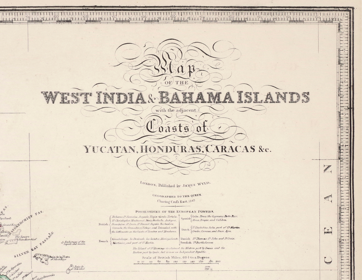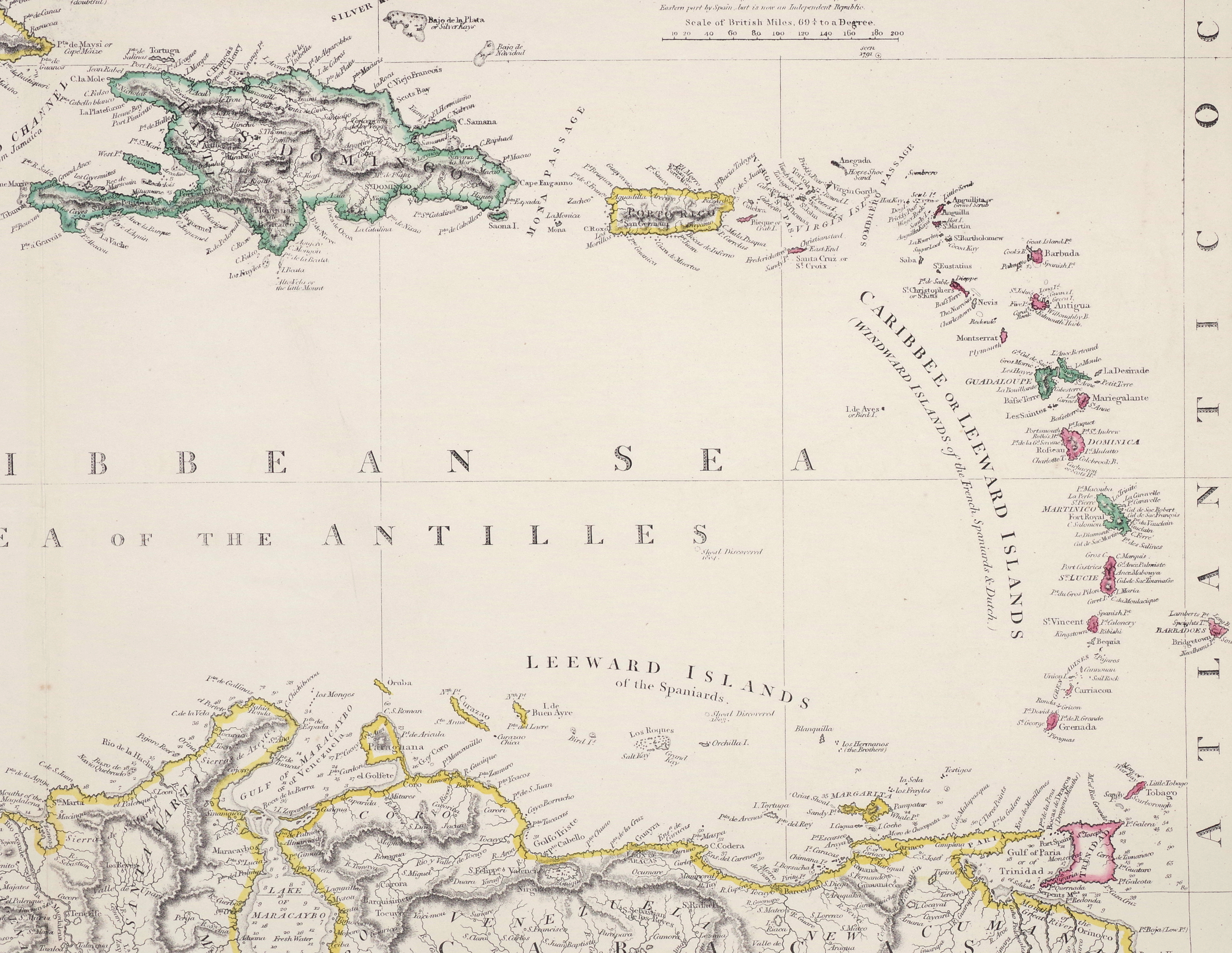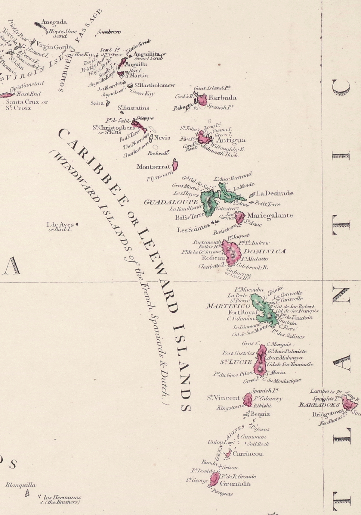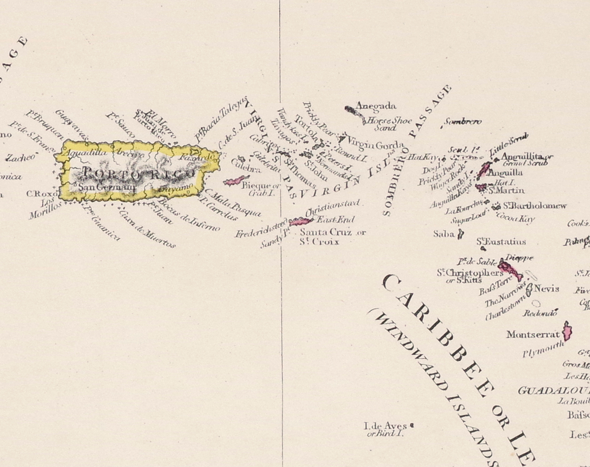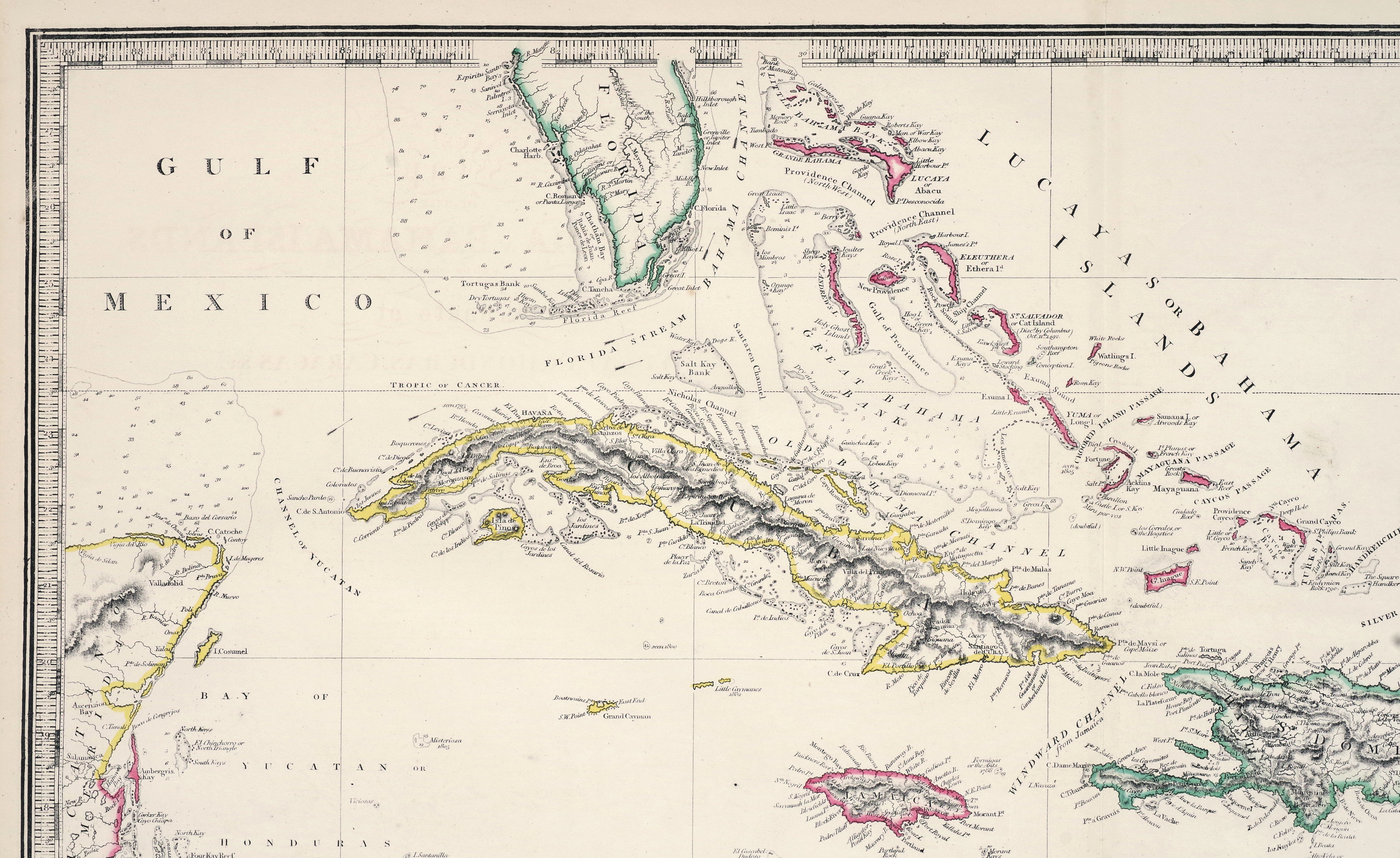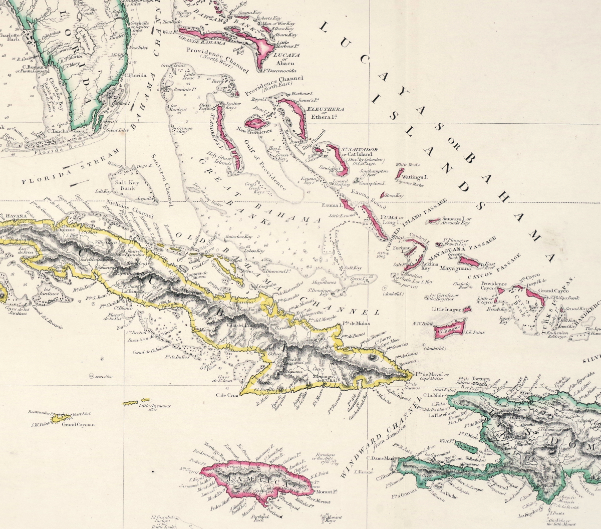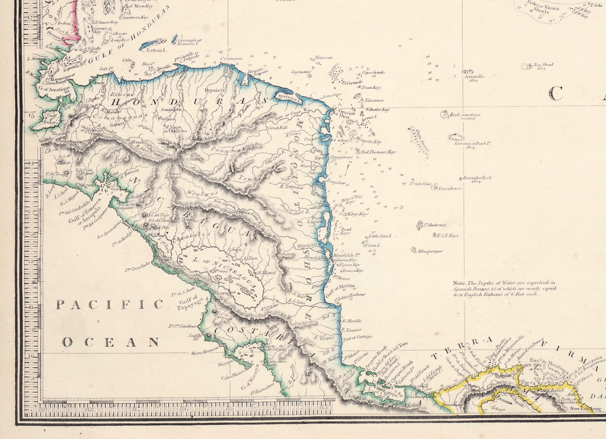
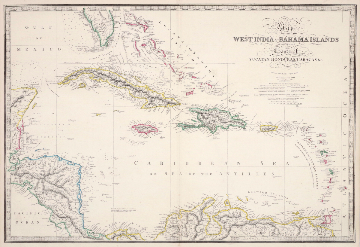
Large 1847 James Wyld Hand-Colored Map of the Caribbean
"The West India and Bahama Islands, with the Adjacent Coast of Yucatan, Honduras, Caracas etc."
Lithograph map hand-colored in outline, 1847, published by James Wyld, "Geographer to the Queen", with ornate title cartouche and printed key outlining the islands under control of the various colonial powers, on wove paper
Neatline 21 x 30 3/4 inches
Sheet 23 x 31 3/4 inches