HOME
MAPS
PAST
CONTACT
North American Maps
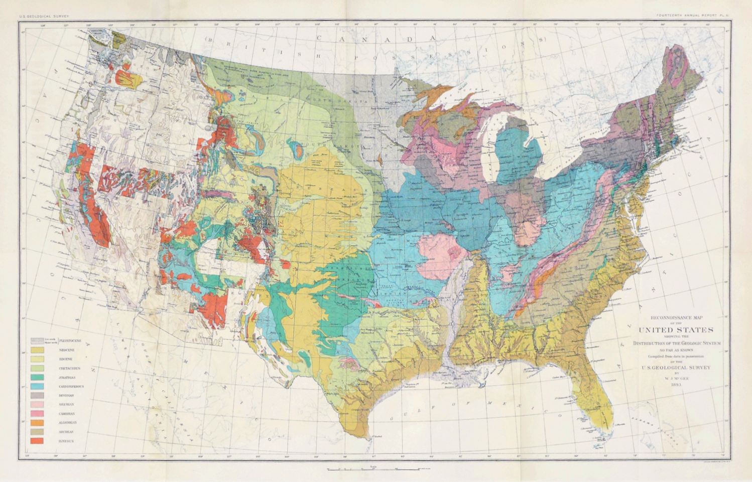
Early Geological Map of the Entire United States, 1893
Early Turnpike Map, 1956
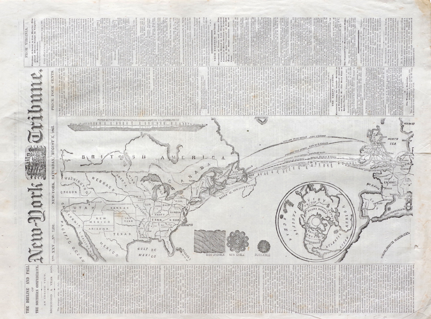
1865 Atlantic Cable Newspaper Map, Printed After The Cable Had Snapped But Before The News Was Known
Complete State of Oklahoma Civil Defense Plan, 1958
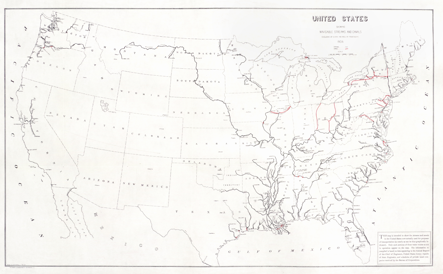
Navigable Waterways in the United States, 1906
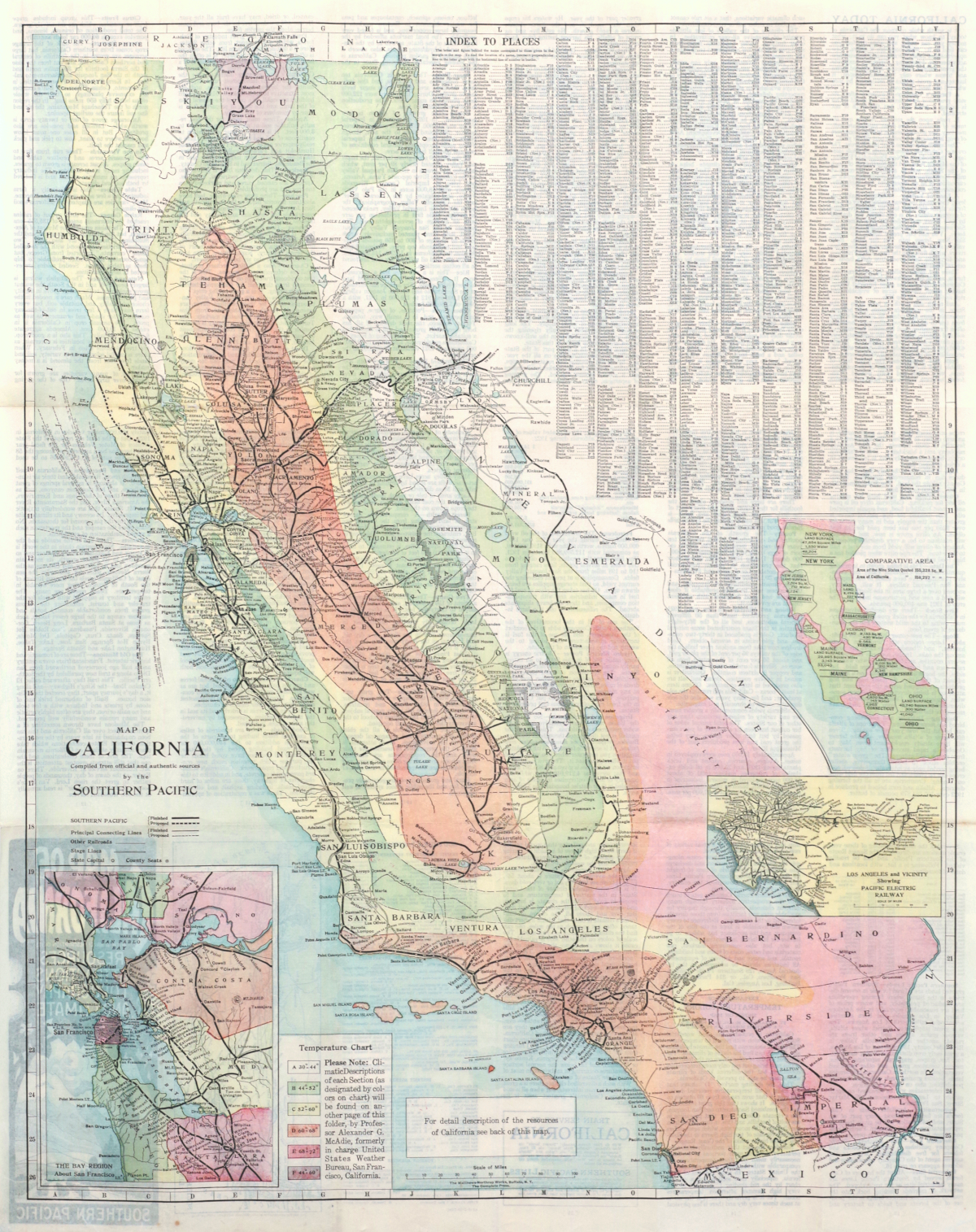
Southern Pacific Map of California,
Railroads & Temperature - 1923
1884 Rand, McNally Pocket Map of Minnesota
Attractive 1920s Automobile Map of Southern California
"Guide Map" of Manhattan and Central Park, 1895
Large 1899 Chart of the Western End of Long Island Sound