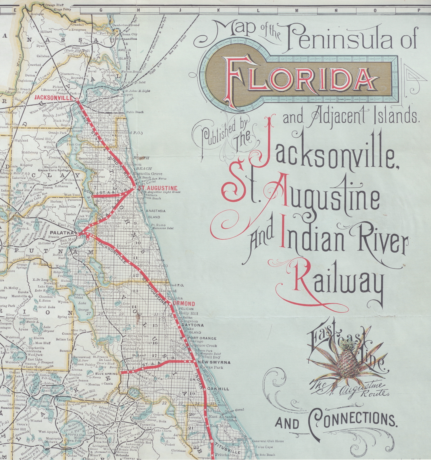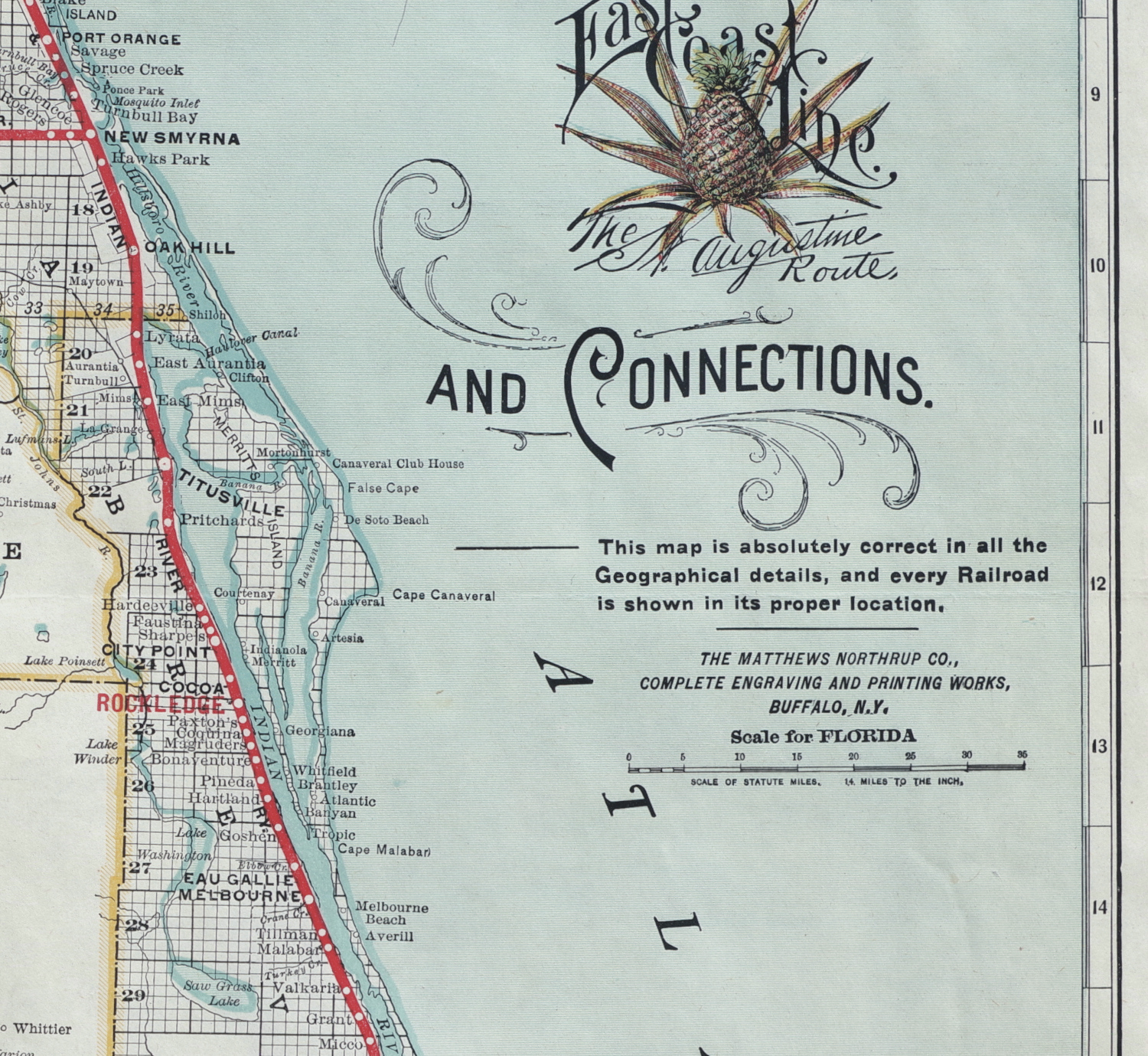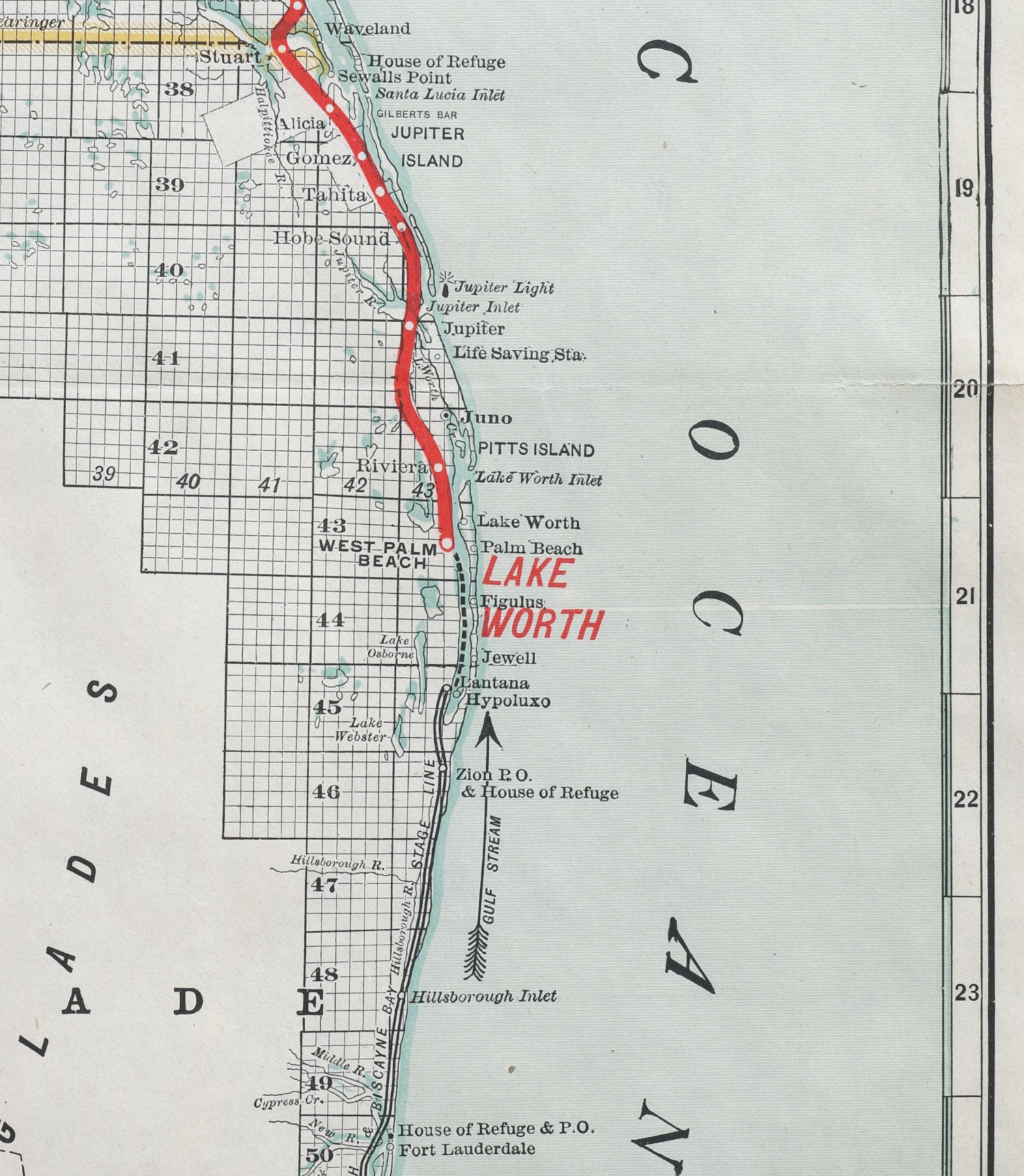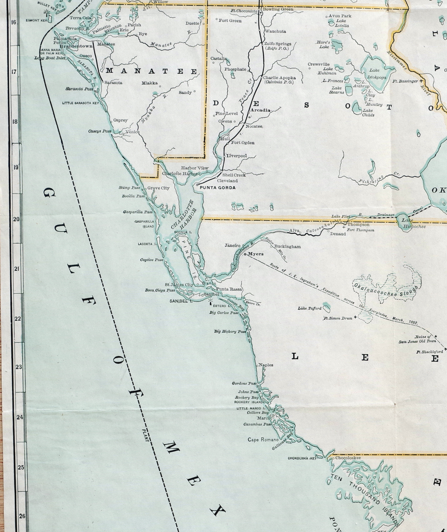
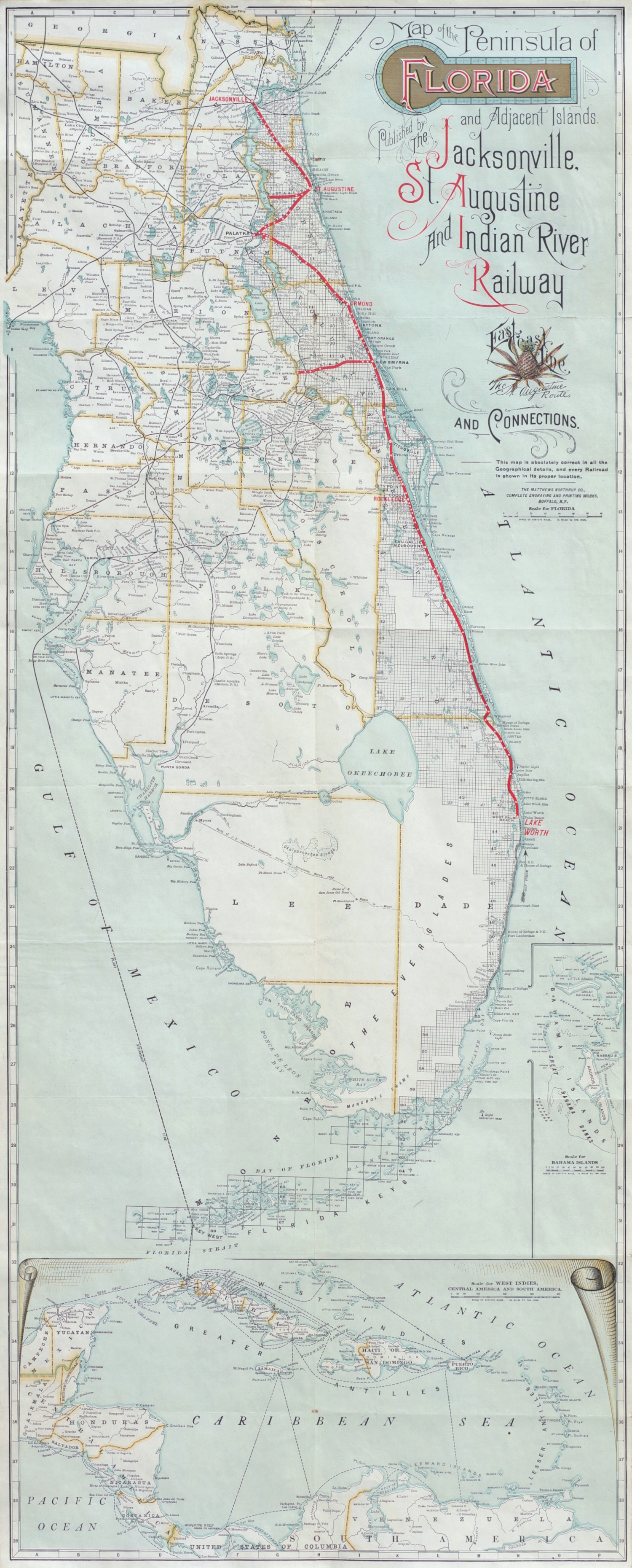
Early State of a Florida Railways Map
"Map of the Peninsula of Florida and Adjacent Islands"
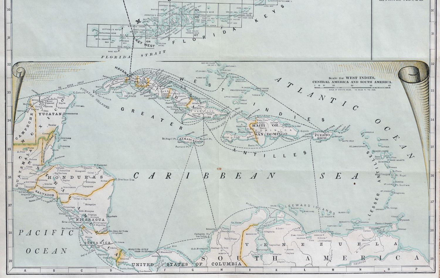
Color-printed map, circa 1894, published by The Jacksonville, St. Augustine and Indian River Railway, and printed by The Matthews Northrup Co, Buffalo, NY, showing the route of the railway line only as far south as Lake Worth (see note below), with two inset maps along the lower-edge showing the Bahamas and Caribbean islands, on thin white paper, with horizontal and vertical folds as issued (now flattened), together with the original printed card covers (with a printed note from the president of The Matthews Northrup Co. regarding the map dated October 1893)
Sheet 39 3/4 x 16 inches
The Jacksonville, St. Augustine and Indian River Railway reached Palm Beach / Lake Worth in 1893. A similar, rare state with Palm Beach instead of Lake Worth printed in red appeared on the market some years ago, however work on the railway proceeded south quickly - reaching Fort Lauderdale in 1893, and we are only aware of another early version of the map in a very few institutional collections.