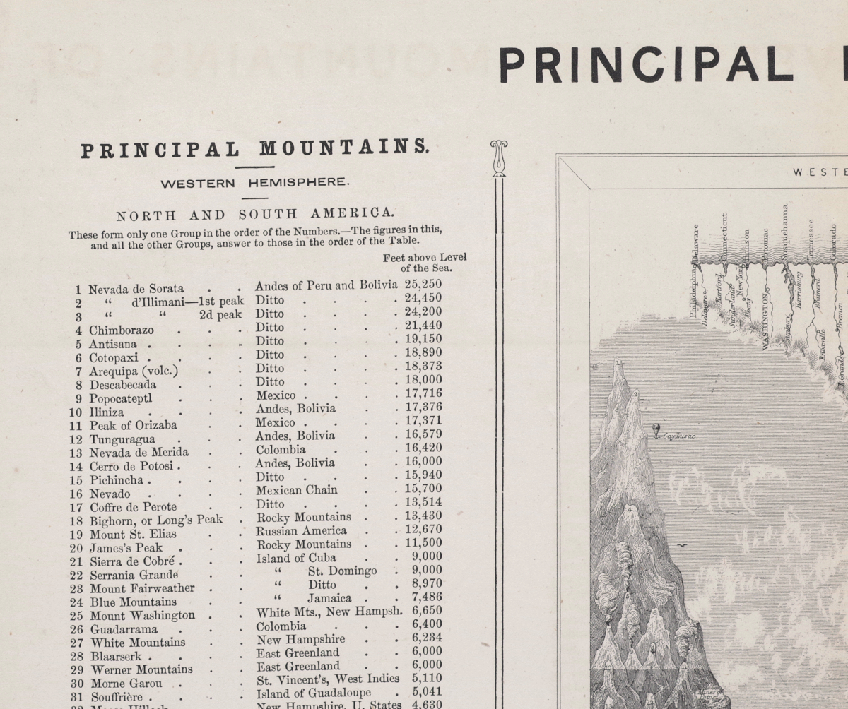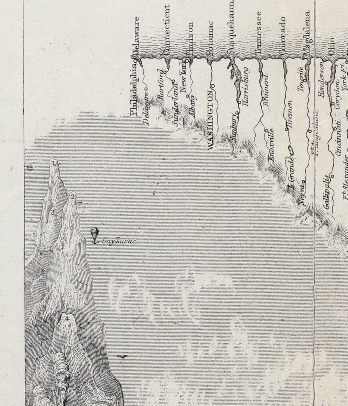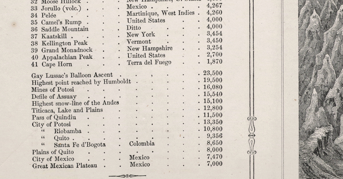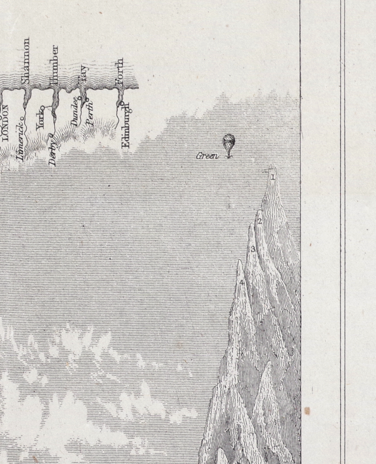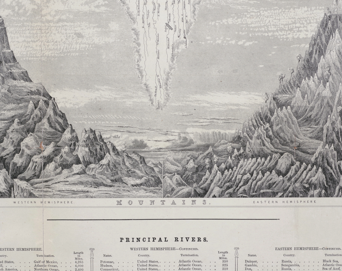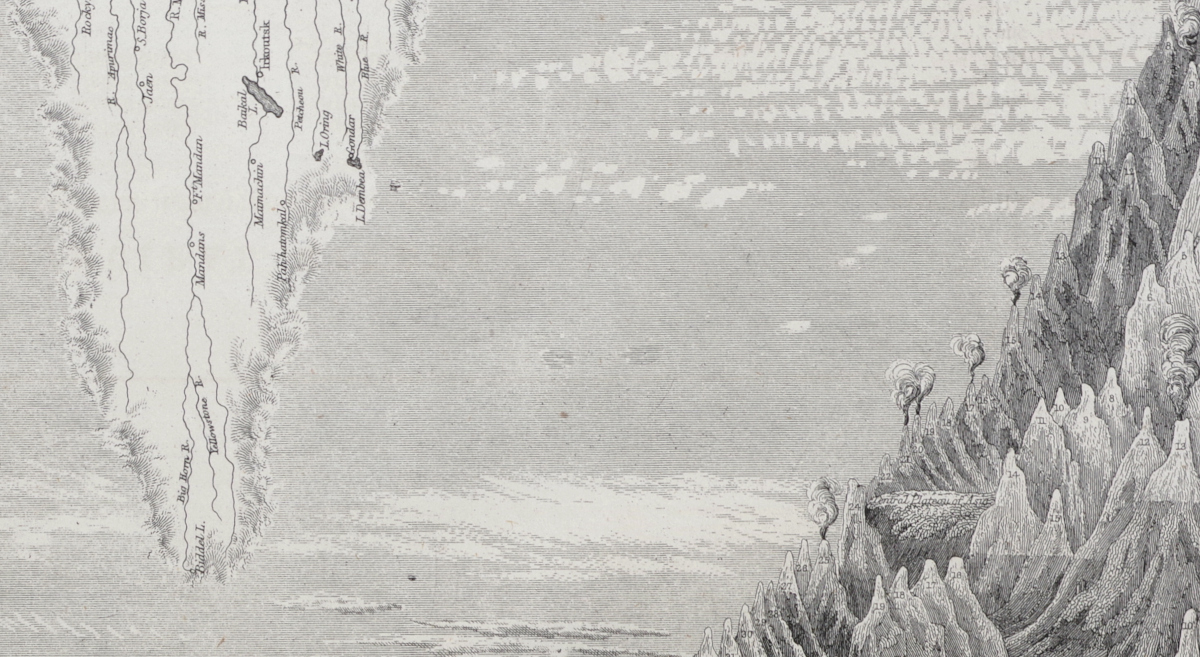
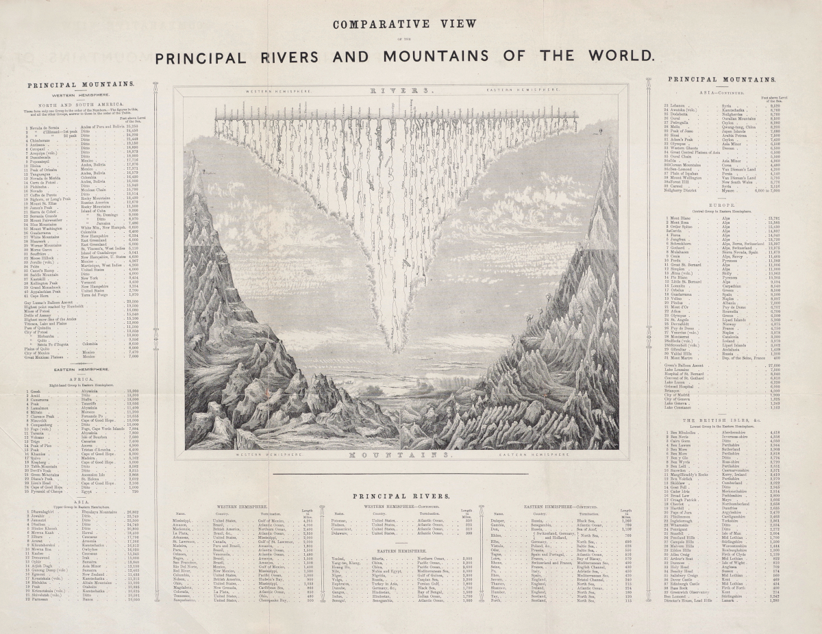
Unusual Comparative Map Showing Balloon Ascents
"Comparative View of the Principal Rivers and Mountains of the World"
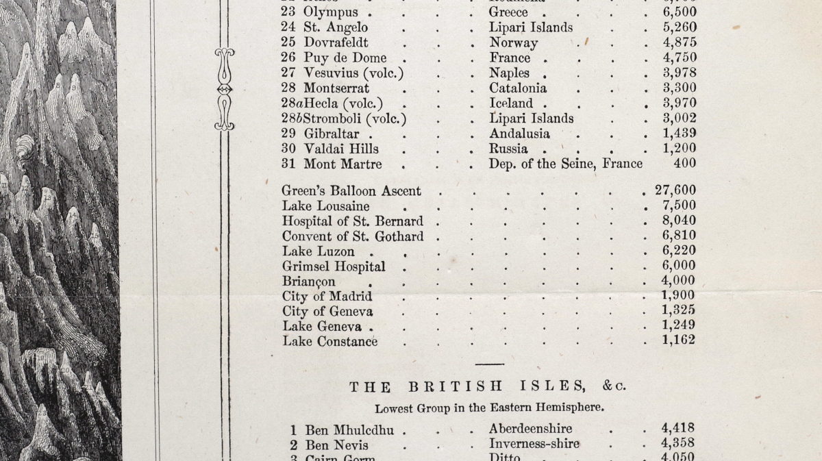
Wood-engraved map, circa 1840, with lists of rivers and mountains of the world printed on three sides, and with two balloon ascents shown graphically on the map - Joseph Gay-Lussac's at upper-left and Charles Green's upper-right (please see note below) - both also listed in the text (as well as the "Highest point reached by Humbolt"), with horizontal and vertical folds as issued (now flattened), on off-white paper
Sheet 16 3/4 x 21 1/2 inches
The French scientist Joseph Louis Gay-Lussac made a hydrogen ballon ascent in 1804 that reached a height of 7,016 metres (23,018 ft) which corresponds closely to the height listed on this map. English balloonist Charles Green made an ascent in a hydrogen balloon in September 1838 that reached a height of approximately 27,000 feet, as noted here. In 1802 Alexander von Humbolt had climbed the Equadorian volcano Chimborazo, reaching a height of approximately 19,000 feet, the highest elevation climbed by a westerner at the time.