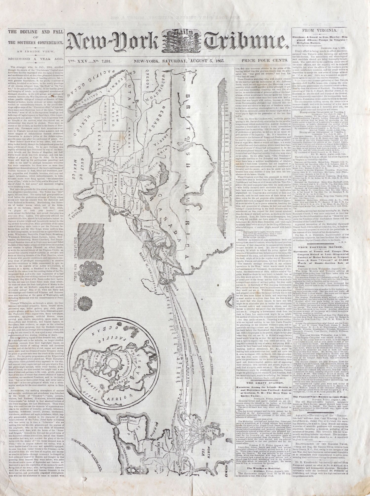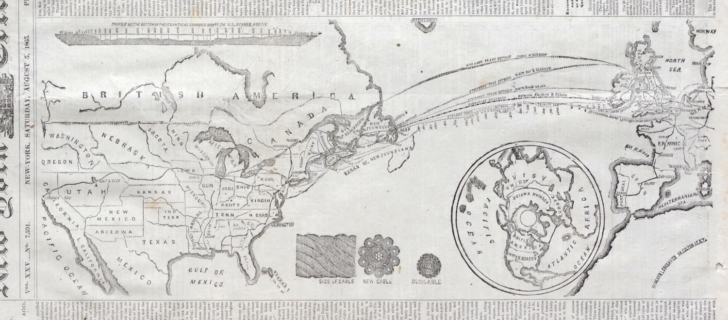
1865 Atlantic Cable Newspaper Map, Printed After The Cable Had Snapped But Before The News Was Known
"New York Daily Tribune" newspaper from 5 August 1865, 8 pages, with a full-page vertical woodcut map of the planned route of the Atlantic cable on the front page, also with inset illustrations showing the design of the new cable, ironically the cable had actually snapped on 2 August, ten days after cable laying had begun, but this news was not known in North America until 15 August, the sheet uncut as originally issued (so, printed on one large sheet folded twice)
Page 21 1/4 x 15 3/4 inches. Full sheet 42 1/2 x 31 1/2 inches
The following short column of text is printed on page four of the newspaper:
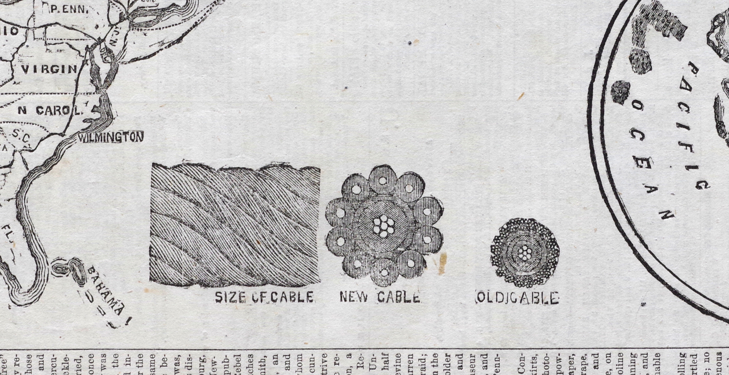
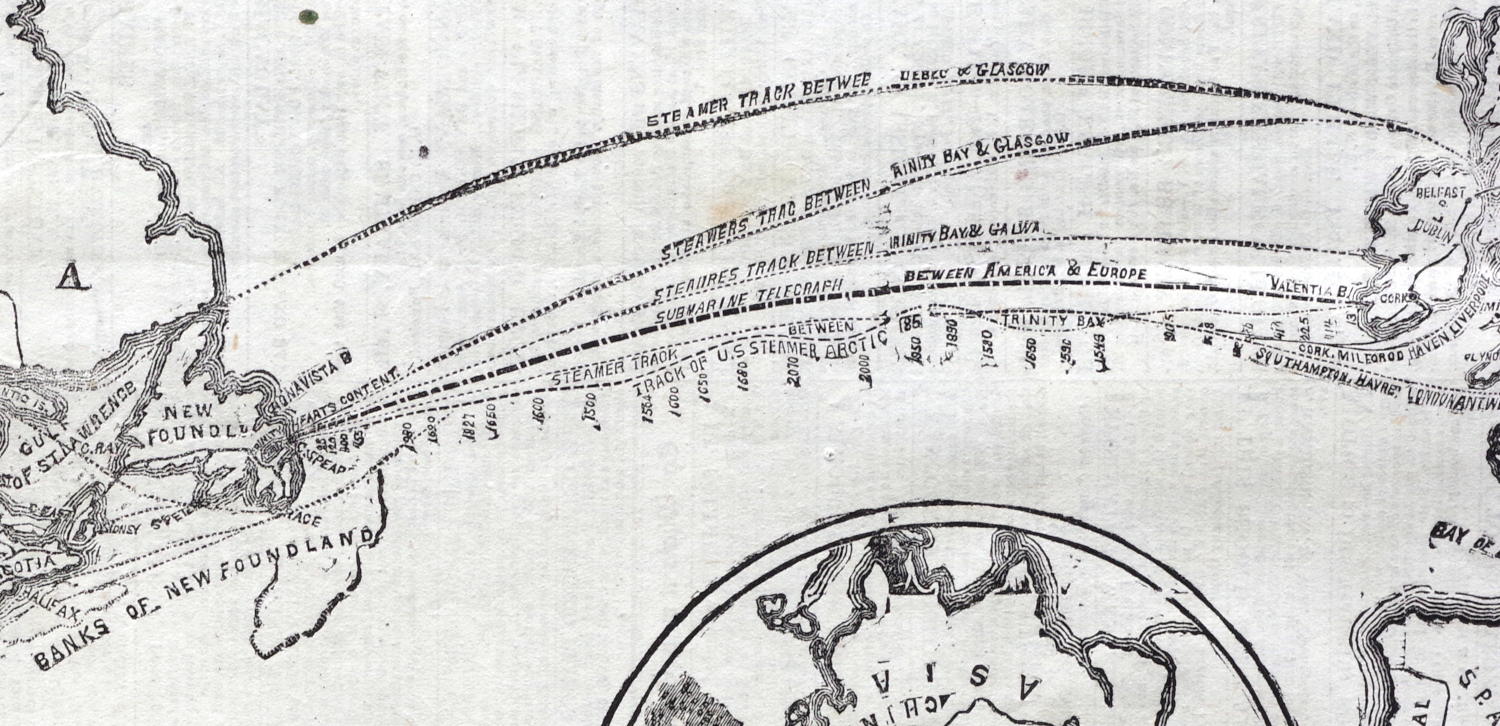
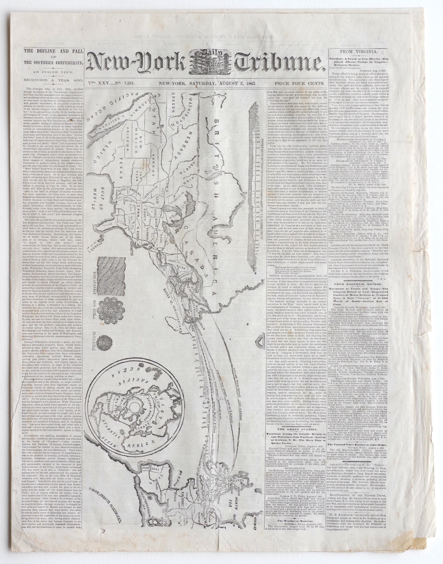
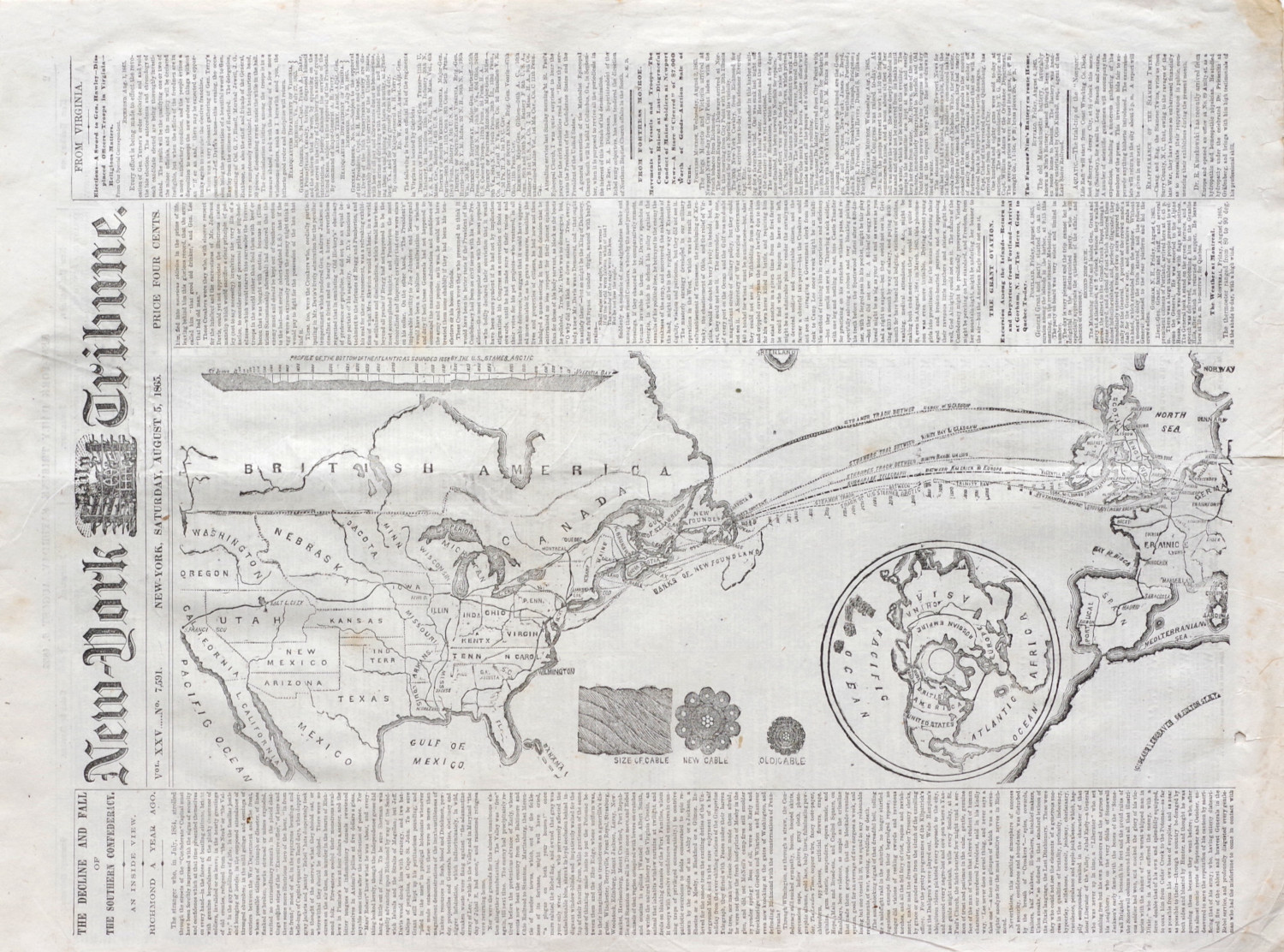
“We print on our first page, this morning, an admirable and correct Map showing the course of the Atlantic Telegraph Cable. If the Great Eastern sailed on the 24th July, she has been out twelve days to-day, and according to the calculation made, is due at Heart’s Content [Newfoundland] on Monday. We hardly expect to hear of her arrival so soon, but in the mean time our readers will be glad to have before them a map showing her course, with other interesting particulars relating to this great and important enterprise. The sizes of the old and new cables are accurately delineated on one edge of the map, and on the other the profile of the ocean bottom according to the soundings made in 1858 by the United States steamer Arctic. The smaller cut shows the course of the line to run through the Russian Empire and down the coast of the Pacific.”