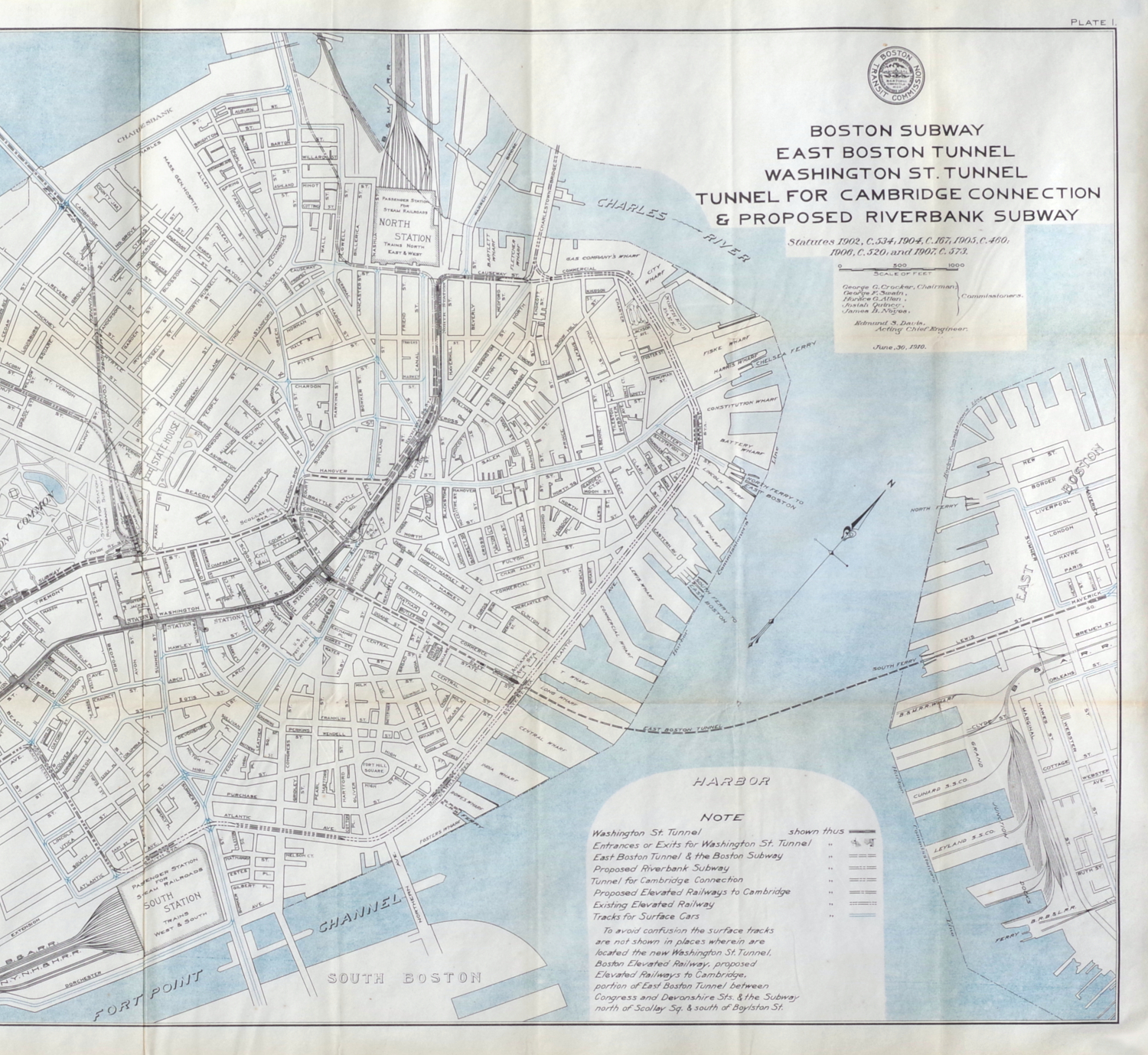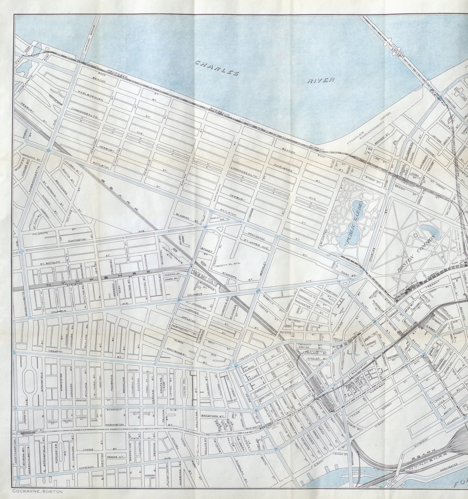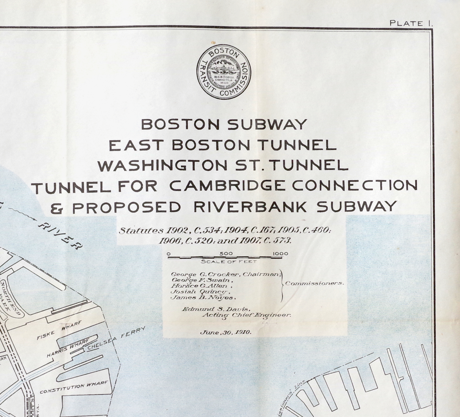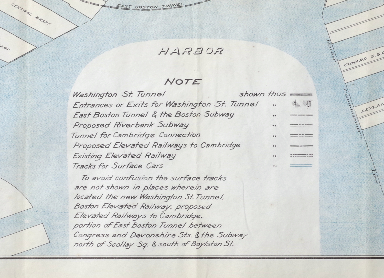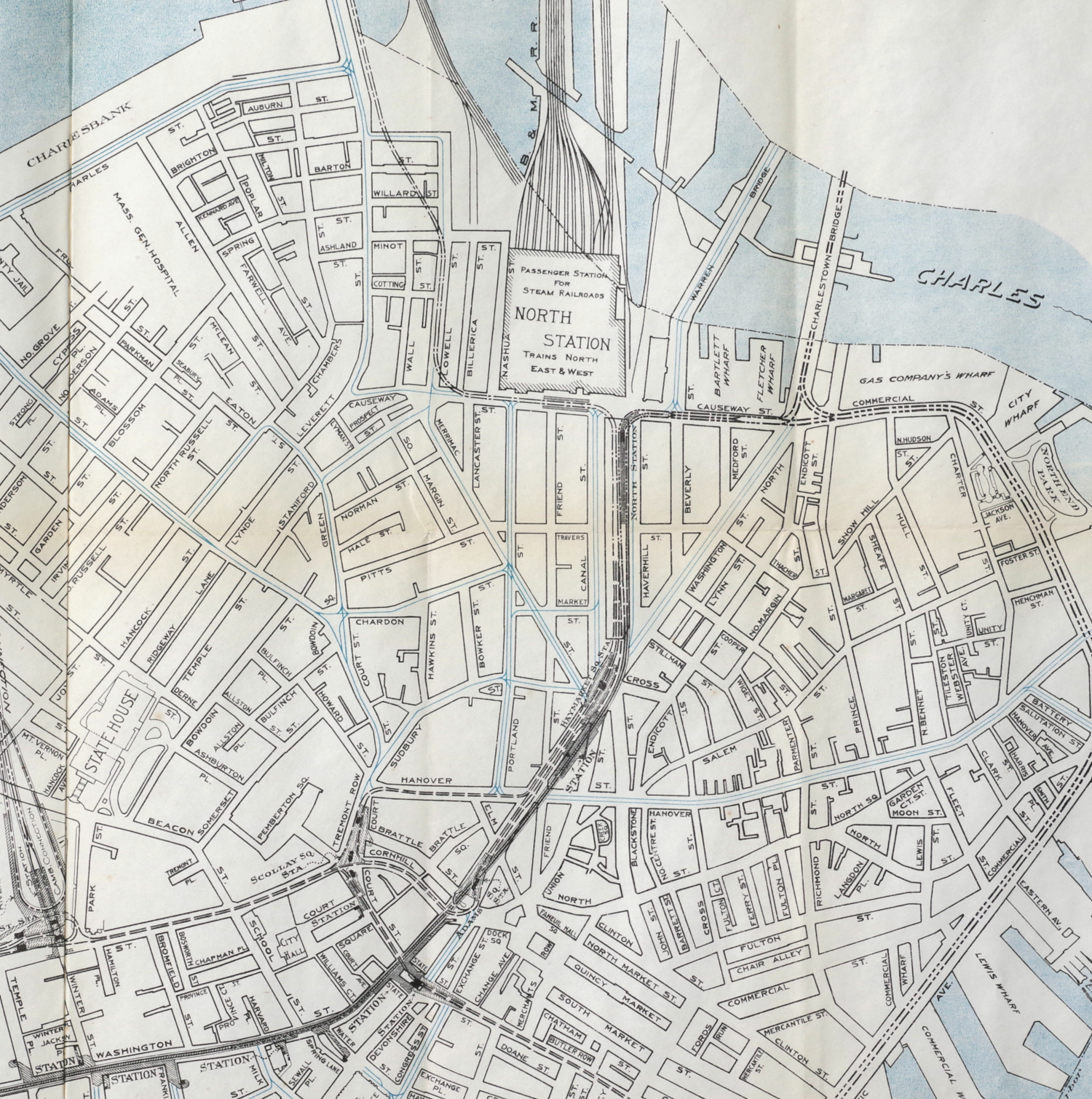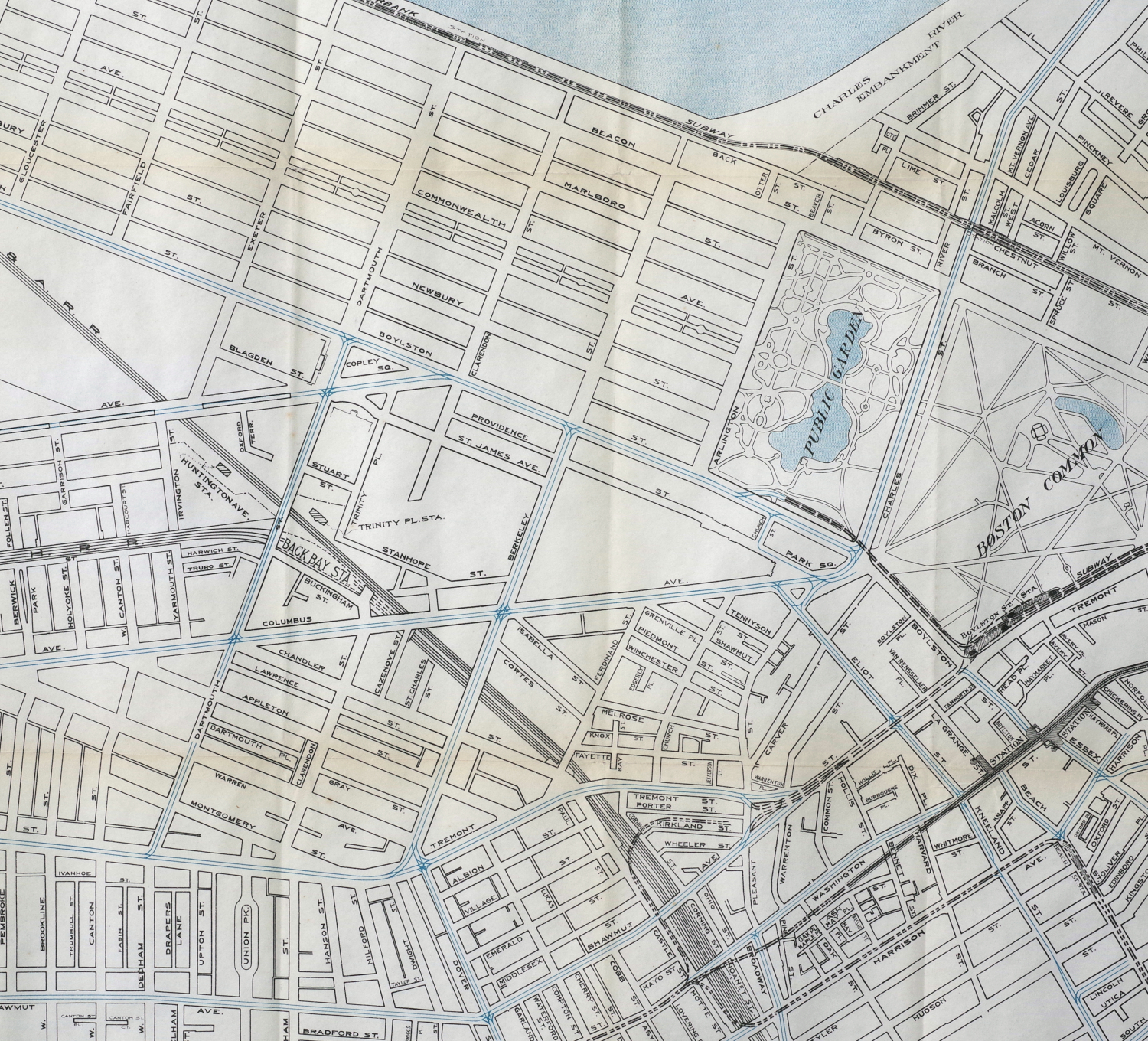
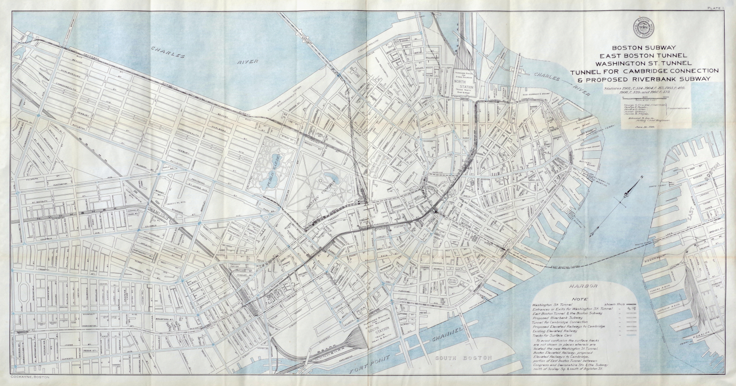
Large Map of Boston's Tunnels, 1910
"Boston Tunnel, East Boston Tunnel, Washington St. Tunnel, Tunnel For Cambridge Connection & Proposed Riverbank Tunnel"
Color-printed map, 1910, published by the Boston Transit Commission and printed by Cockayne, Boston, showing existing and proposed tunnels as well as elevated railway lines, on thin off-white paper, with horizontal and vertical folds as issued (now flattened and less pronounced than they appear in these photographs); some slight toning, particularly along the horizontal folds, a vertical fold crease in the center of the sheet, and a few very slight holes at some fold joins, but otherwise in good condition
Sheet 25 1/4 x 47 3/4 inches
PURCHASING INFORMATION