Graphic Cold War Map of Berlin
"Berlin"
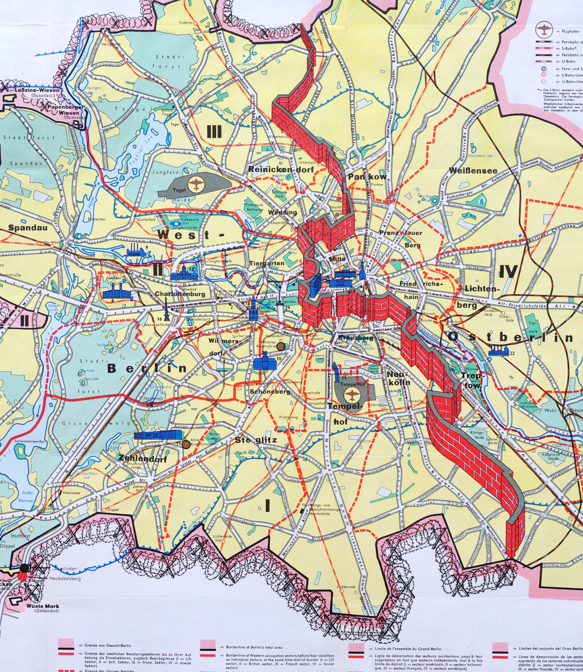
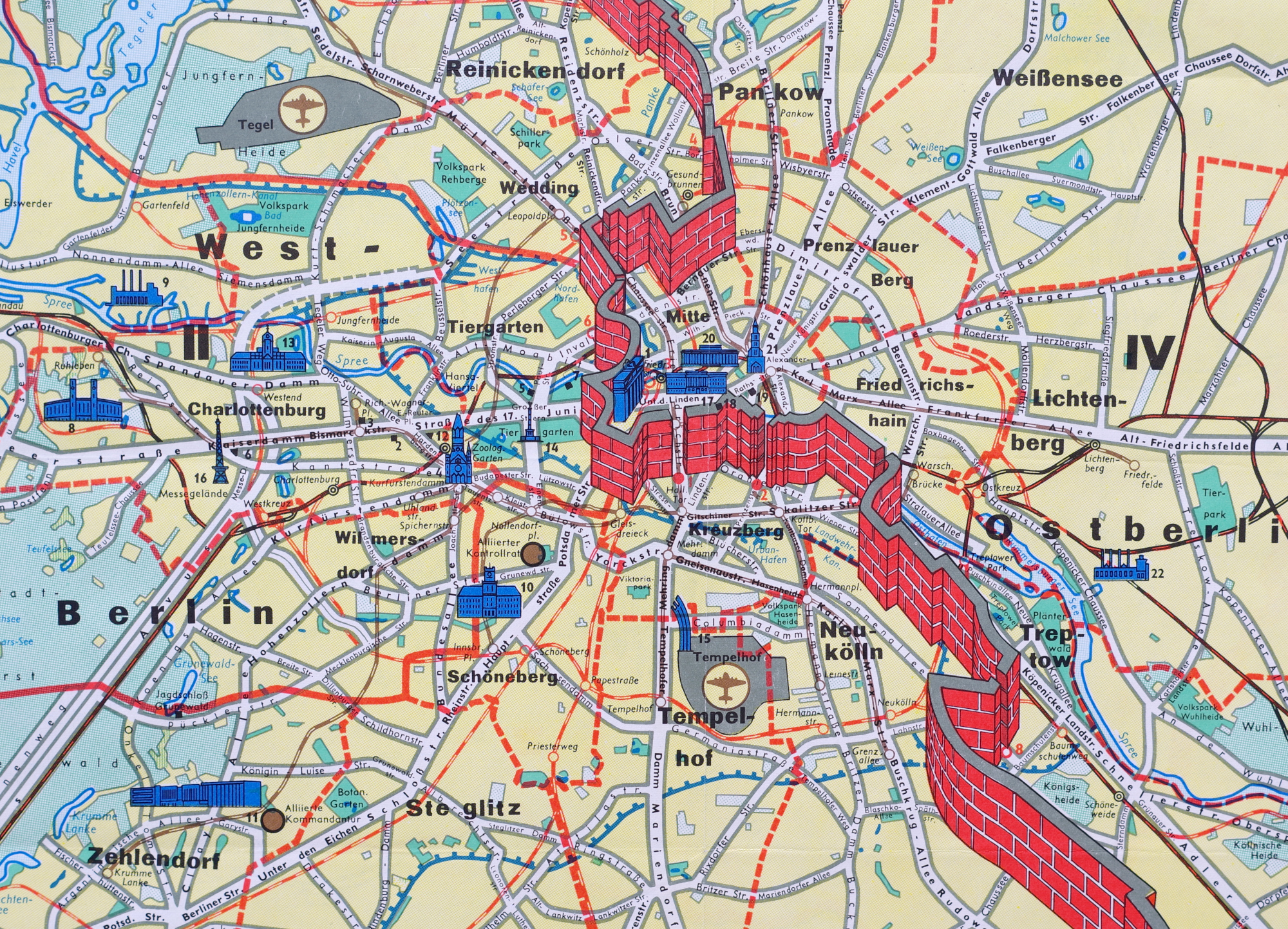
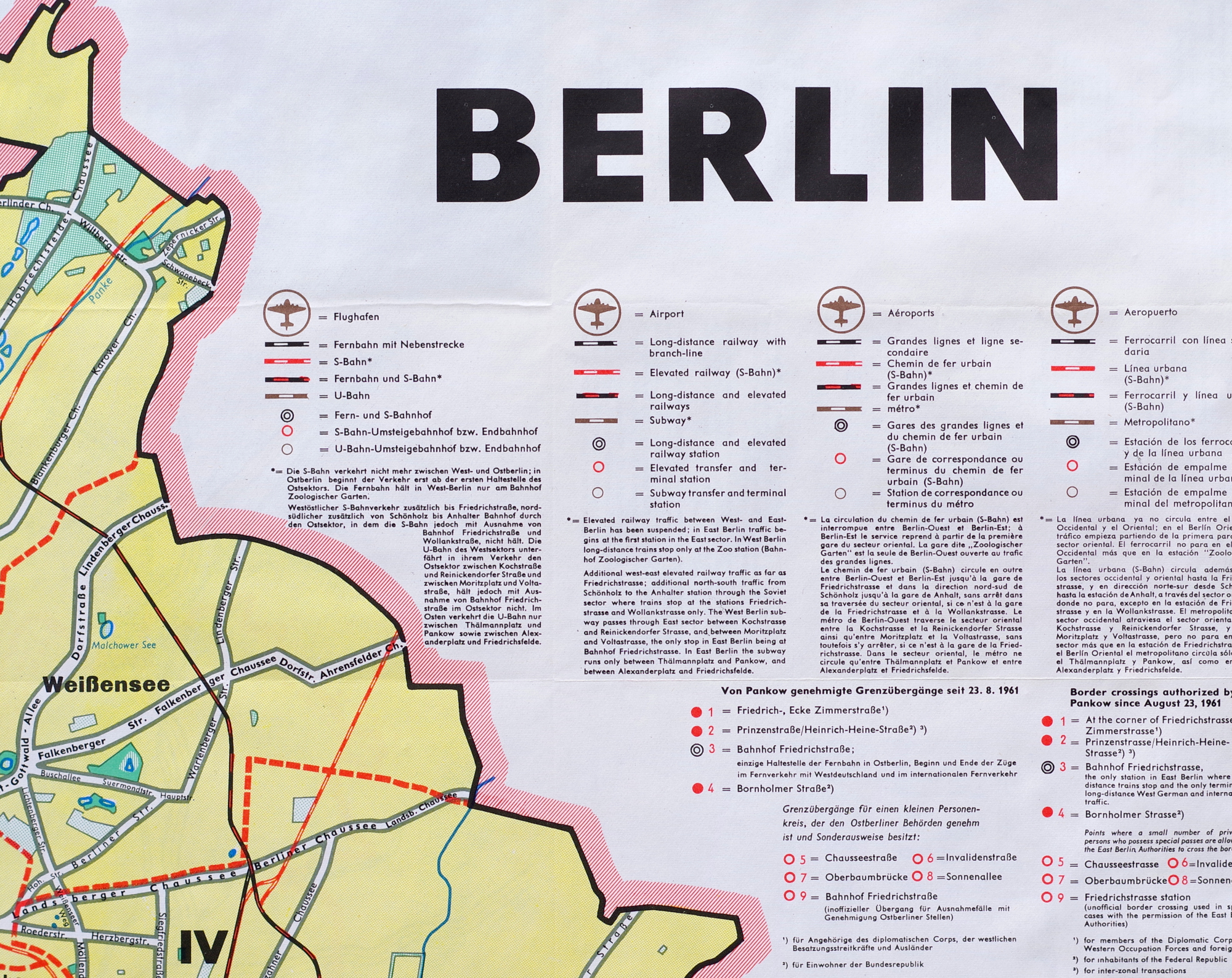
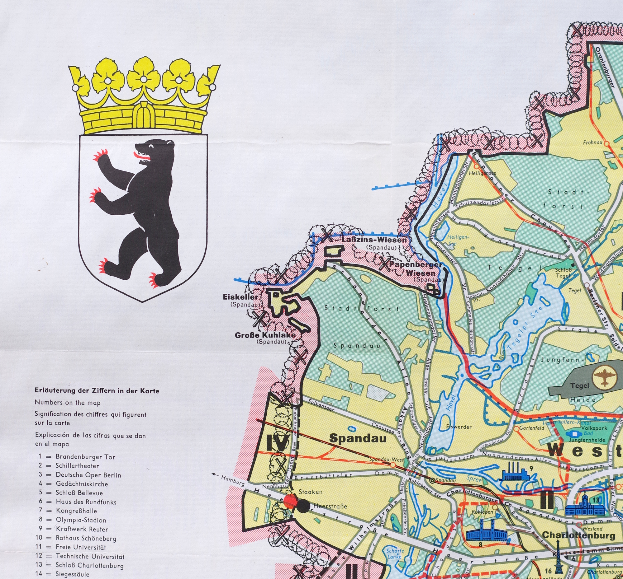
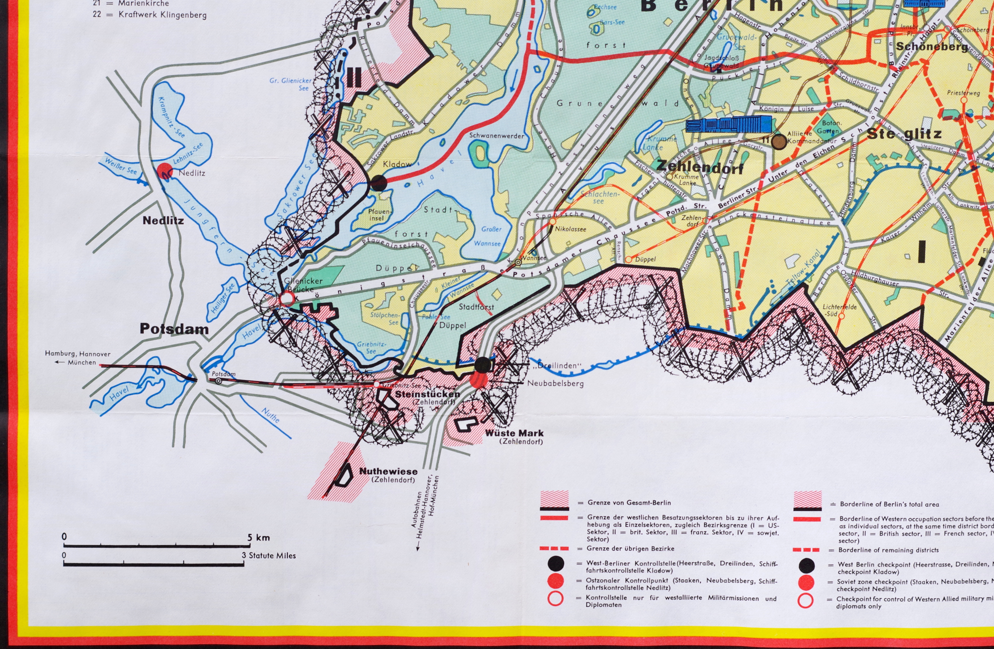
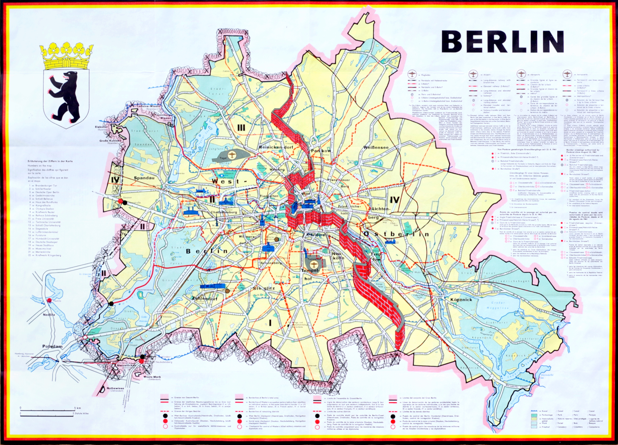
Color-printed map, 1962, graphically showing the divided city with a stylized wall down the center and barbed wire around the remaining perimeter of West Berlin, with printed text in German, English, French and Spanish, with a smaller map of West Germany on the reverse (showing the air corridors into the city), various statistical charts, as well as photographs of sites in the city, published by JRO-Sonderkarte (their name on the title panel on the reverse), with horizontal and vertical folds as issued (now flattened); in excellent condition with bright colors
Sheets 23 3/4 x 33 inches
PURCHASING INFORMATION