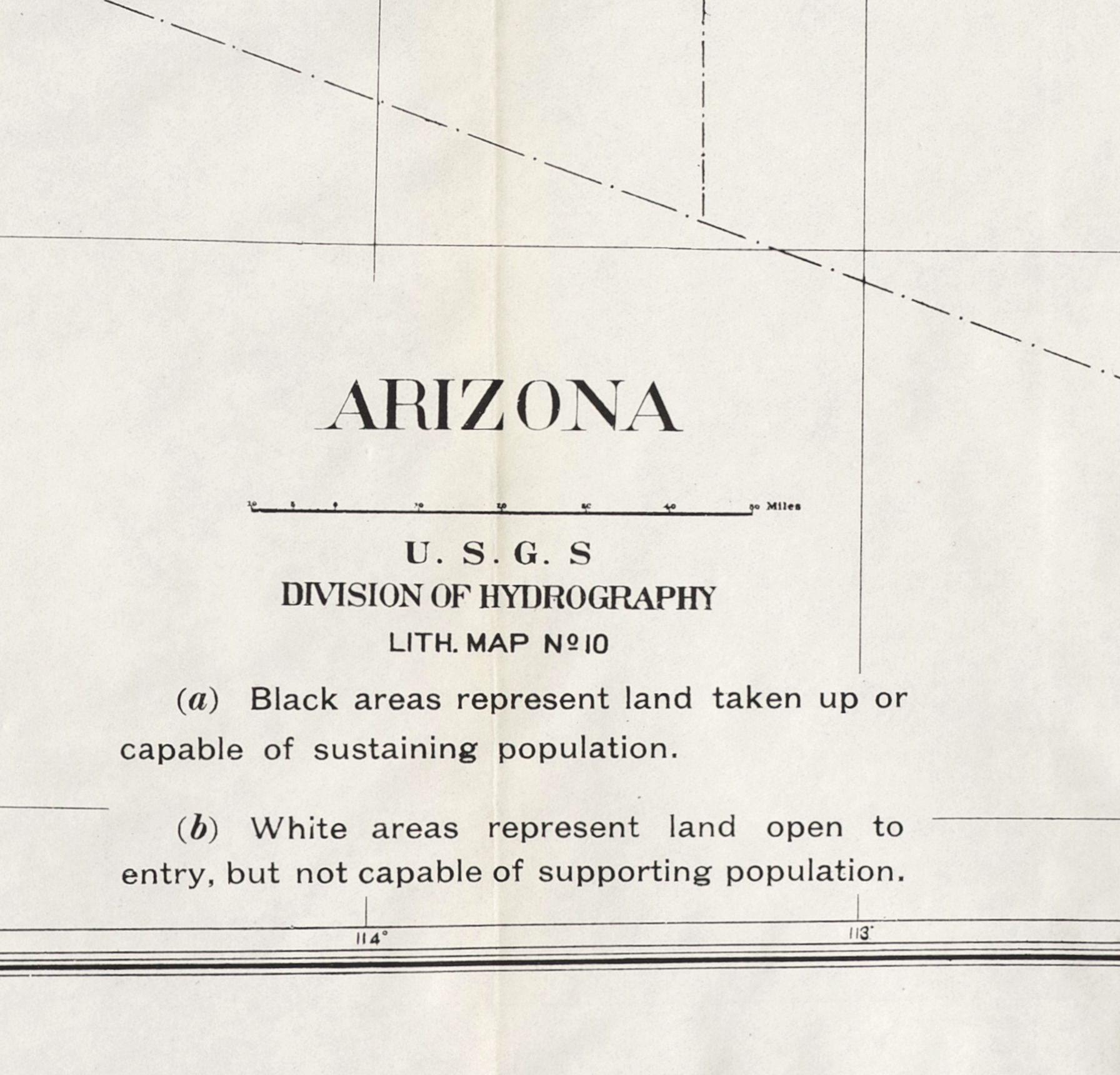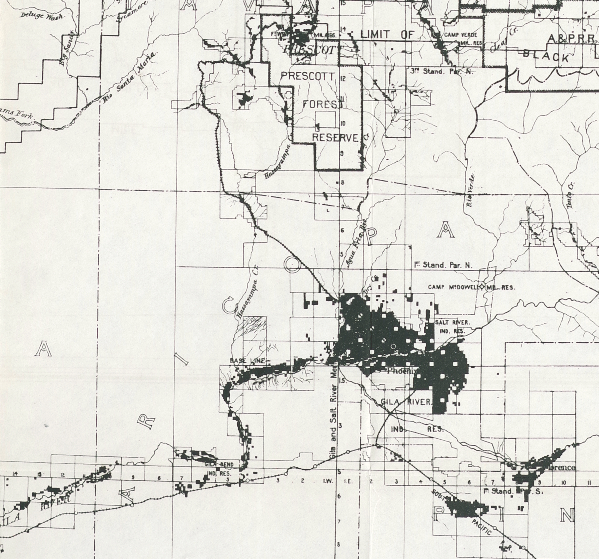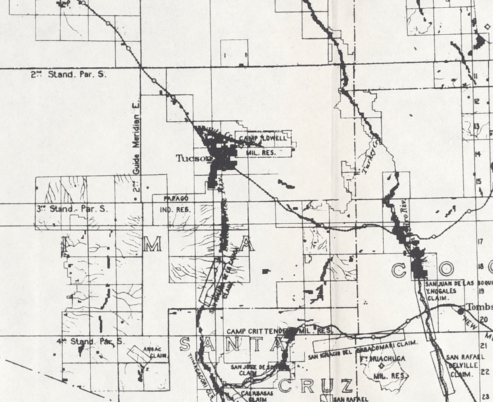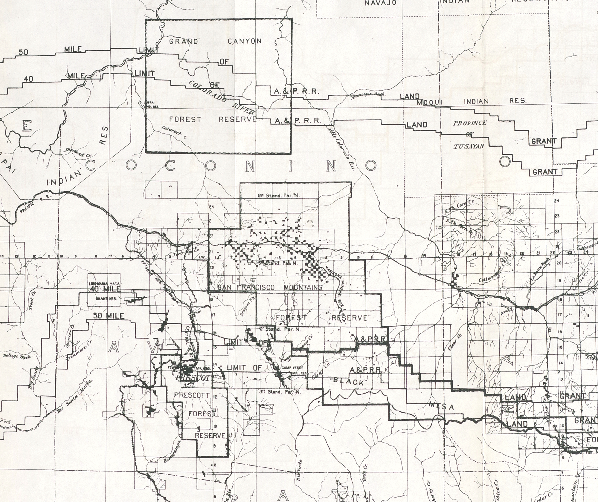
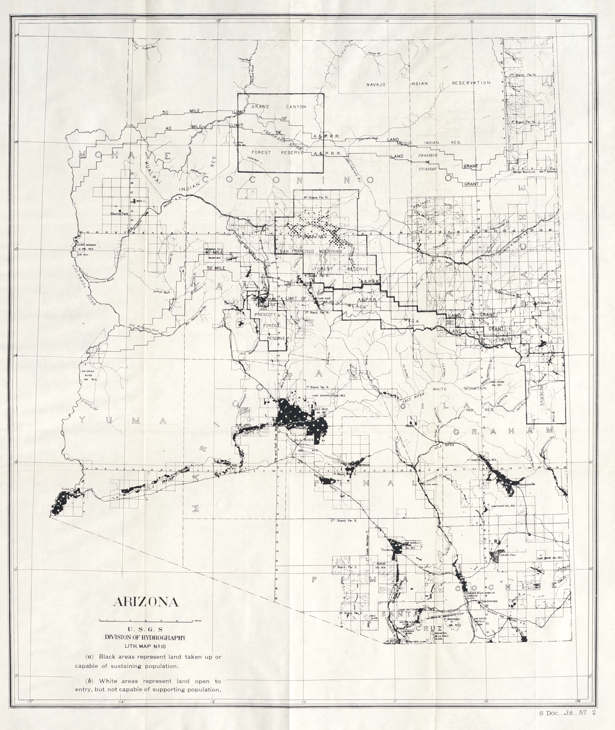
Map of Arizona Showing Areas with Sufficient Water for Settlement
"Arizona"
Lithograph map, circa 1902, prepared by the US Geological Survey Department of Hydrography for a report considering admission of the territory as a state, on thin off-white paper
Sheet 23 1/2 x 20 inches